The first stop of the day…. The Cliffs of Moher. Check out these wicked facts from the site (http://www.cliffsofmoher.ie/)
- The Cliffs are 214m high at the highest point
- range for 8 kilometres over the Atlantic Ocean on the western seaboard of County Clare
- The Cliffs of Moher take their name from a ruined promontory fort “Mothar” which was demolished during the Napoleonic wars to make room for a signal tower
Also…. For those of you who are Harry Potter fans the cliffs in the Half Blood Prince are.. ah hem… The Cliffs of Moher. Also the cliffs are in Father Ted, one of my favorite British shows. It’s in 2 episodes Tentacles of Doom and Cigarettes and Alcohol and Rollerblading.
Epic
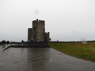
you can see O'Brian tower there in the distance
O'Brian Tower
ME!!
- is a karst-landscape region in northwest County Clare, in Ireland. It is one of the largest karst landscapes in Europe
- measures approximately 250 square kilometres
- The rolling hills of Burren are composed of limestone pavements with crisscrossing cracks known as "grikes"
-region supports arctic, Mediterranean and alpine plants side-by-side
close up of the ground
Next came the Aliwee Caves. I forgot how cool caves were. The last time I was in a cave was when I was pretty young so I was excited for this part. We were in groups of 35 and I was at the back with my group of American friends. We couldn’t hear much of the tour so we goofed off the whole time and made our own little tour.
These facts are from wikipedia and http://www.aillweecave.ie/
- This cave was formed by the glacial melt waters of an early ice age
- The name Aillwee is derived from the Irish Aill Bhuí which means yellow cliff.
- consists of over a kilometer of passages
- Roughly 300 meters of cave passage is open to the public, one third of the total length of the cave. The tours end at a point called the highway and exit the cave via a 250 meter manmade tunnel
- It was discovered in 1944, when a farmer named Jacko McGann followed his dog who was chasing a rabbit. The farmer did not explore very far into the caves, and did not tell anyone of the find for nearly 30 years.
The waterfall in the cave
Our last stop was Bunratty. There was a castle there…
That was as close as I got. It was raining and we only had 30 minutes to explore. There was also the fact that I was tired as hell by this point.
Over all I had a fantastic day and man I got some super sweet pictures!!
Cheers,


No comments:
Post a Comment